To track down the best GPS trackers for hiking, you’ll need to really consider your needs and the features that are right for you. We recommend looking at trackers with high-sensitivity trackers with access to multiple satellite networks and reliable, worldwide coverage. Make sure you consider the durability and weatherproofing of the device, as well as its battery life and the ability to swap in new batteries if needed. Always consider the screen size and interface, controls, and any advanced features when buying a GPS for hiking.
Ultimately, we’ve determined that the Garmin GPSMAP 64x is the best GPS tracker for hiking you can buy today after researching over 50 different devices with a range of features and prices. Keep reading to find out what you need to know about our top picks for the best GPS trackers.
Top 10 Best GPS Trackers for Hiking
#1 Garmin GPSMAP 64x GPS Tracker for Hiking
Award: TOP PICK
WHY WE LIKE IT: Hike anywhere and everywhere with the rugged, reliable Garmin GPSMAP 64x that uses the power of GPS, GLONASS, and Galileo satellite networks. Whether you’re pre-planning your route or working on-the-fly, you can rely on this compact handheld GPS for all of your outdoor adventures.
- Multi-GNSS navigation
- microSD expandable storage
- Preloaded trail maps
- Rechargeable battery option is extra
The Garmin GPSMAP 64x is a fantastic all-around handheld GPS that will fulfill the needs of most hikers. Its 2.6” TFT color screen is large enough to read your satellite or topographic maps while keeping the device fairly light at only 8-ounces. The screen is sunlight-readable, and the entire unit is impact and water-resistant.
This Garmin benefits from having physical buttons to control your navigation, which is ideal when you’re operating the GPS with gloves on or in inclement weather. Its high-sensitivity receiver enables you to connect to multiple satellite networks — GPS, GLONASS, and Galileo — giving you the strength of each at various altitudes and locations. This feature easily makes it one of the most accurate handheld GPS devices you can buy today. The device also comes preloaded with TopoActive Maps, a topo map program that gives you access to popular routes, trails, and roads for hiking. You can view information on difficulty, terrain type, and more. To protect your phone, you might also like the best GPS phone tracker.
#2 Garmin inReach GPS Tracker for Hiking
Award: HONORABLE MENTION
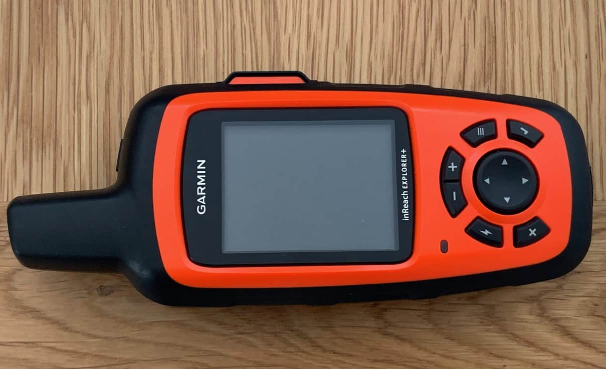
WHY WE LIKE IT: The inReach Explorer+ gives hikers access to advanced sensors for direction and altitude, as well as access to the world’s most extensive satellite network, Iridium.
- 24/7 SOS emergency response center
- 100-percent GPS coverage anywhere in the world
- Preloaded trail maps
- Messaging can be expensive depending on your plan
For a relatively compact and lightweight handheld GPS, the inReach Explore+ is packed with a range of advanced features. The inReach uses the Iridium satellite network, which is the largest commercial satellite network in the world, and the only one that offers coverage no matter where you go in the world. As such, the inReach enables you to send messages to cell phones and emails even when there is absolutely no cell service. It also gives you peace-of-mind, as you can trigger an SOS alert in case of an emergency to get connected with someone and get help.
Other advanced features include a digital compass, accelerometer, and a barometric altimeter. The barometric altimeter keeps you updated on your elevation up to 30,000 feet within at least 50 feet accuracy. You’ll also have access to weather reports based on day and time of day, including percent chance of precipitation. These advanced sensors help you easily plan for every aspect of your hikes. For the biker in your life, the best GPS tracker for bikes buying guide can help you find the right technology to protect your bike.
#3 Garmin Instinct GPS Tracker for Hiking
Award: BEST HANDS-FREE DEVICE
WHY WE LIKE IT: The Garmin Instinct GPS tracker is a multi-GNSS navigation tool, fitness tracker, and smartwatch all-in-one. It’s built for the toughest outdoor conditions while being just as useful at the gym and in daily life.
- Health, activity, and fitness data
- Military-grade fiber-reinforced polymer construction
- Bluetooth enabled to pair with smartphone
- Monochrome display
The Garmin Instinct gives hikers hands-free, easy access to all the essential GPS and navigation features you need, and then some. This hiking GPS watch is built to military-grade standards for thermal, shock, and water resistance. Its display is chemically-strengthened, scratch-resistant glass that is high contrast for easy readability in every condition. Battery-life can be as long as 14 days depending on which mode the watch is in. Full GPS mode will give you around 16 hours, though Garmin also offers an UltraTrac mode that gives you access to GPS but will work to preserve the battery when you’re not actively using it.
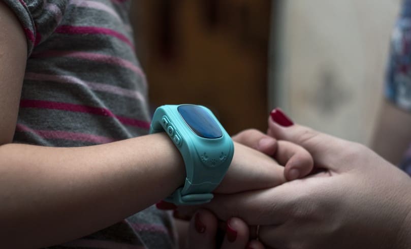
For such a small device, the Garmin Instinct offers an impressive amount of advanced features, including health monitoring, navigation sensors, and smart tech options. Monitor your heart rate at rest and in motion, and receive alerts if the watch detects any abnormalities. Advanced navigation sensors include a barometric altimeter, compass, accelerometer, and thermometer. Instinct is Bluetooth enabled and compatible with iPhone and Android, which gives you additional controls and messaging capabilities. If you have kids, the best GPS trackers for kids can help you keep them safe.
#4 Garmin eTrex 10 GPS Tracker for Hiking
Award: BEST ON A BUDGET
WHY WE LIKE IT: The Garmin eTrex 10 is the best budget GPS for hiking as it provides access to worldwide GPS and GLONASS satellite coverage via a highly-sensitive WAAS receiver that other devices in its class generally do not offer.
- Outstanding 25-hour battery life
- Tracks GPS and GLONASS satellites simultaneously
- Access to Garmin’s higher-priced software included
- No advanced navigation sensors
You won’t break the bank on the eTrex 10, and you won’t have to worry about breaking this rugged device that’s IPX7 waterproof rated. This device offers extremely reliable core navigation functionality, including both GPS and GLONASS support. It’s very lightweight at only five-ounces with batteries. Battery life is outstanding, too, at up to 25 hours. It works off of two AA batteries with the option to use NiMH or lithium rechargeable batteries.
The user interface is straightforward and easy to use, giving you the ability to access maps, your compass, your trip computer, and mark waypoints. You can easily look-up and follow saved routes or plan a new one directly on the GPS. eTrex will estimate the time and distance between points. The device also allows you to customize your dashboards so that they include the navigation info that’s most useful to you. If you’re a dog owner, you might also check out our best dog GPS tracker buying guide.
#5 Bad Elf 2200 GPS Tracker for Hiking
Award: BEST FOR USE WITH SMARTPHONES
WHY WE LIKE IT: This external GPS receiver enables your smartphone or tablet to become a high-performing navigational device. You can use your favorite map programs with more detailed insight on latitude, longitude, altitude, speed, and more.
- Pair up to five devices simultaneously
- Fast location updates 10 times per second
- Compatible with your favorite navigation apps
- No built-in map view
The Bad Elf 2200 is a powerful GPS receiver that allows you to receive advanced nav info straight to your device. Bad Elf is Bluetooth enabled and uses it to connect to your smartphone and tablet. In fact, you can pair it with up to five different devices simultaneously. It’s compatible with iOS, Android, and Windows platforms.
This device has a quick setup similar to any other Bluetooth device you would pair with your phone. While you can use Bad Elf’s dedicated app, this GPS receiver will actually send real-time navigation info to most major map apps as well. It processes and reports location data to your device at a rapid rate of 10 times per second, which is configurable to your needs and as a way of preserving battery life. The Bad Elf 2200 can also store over 100 hours of GPS data in the device itself without being connected to your phone. Its small yet useful screen displays your heading, speed, altitude, and other core navigation data. To secure your vehicle, we’ve also identified the best car trackers.
#6 Garmin Montana 680 GPS Tracker for Hiking
Award: BEST ALL-IN-ONE DEVICE
WHY WE LIKE IT: All of the advanced tech features of this Garmin device make it a powerful all-in-one navigational tool. Plan and track your routes easily via the touchscreen while adding pictures and advanced directional and elevation data.
- 3-axis accelerometer
- Built-in camera with auto geo-tagging
- Glove-friendly, high-res color touchscreen
- Doesn’t include storage case
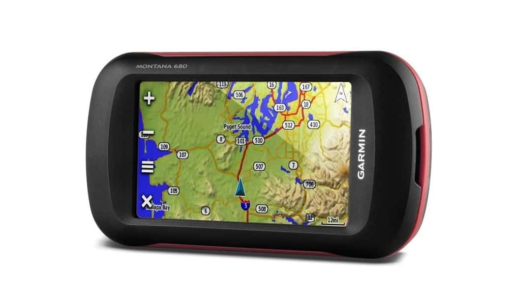
You may forget about your smartphone after using the Garmin Montana 680. Its bright, sunlight-readable, dual-orientation touchscreen display is very user-friendly and built for outdoor conditions. You can easily navigate all of the device’s features by touch, even with gloves on. This GPS also has a built-in eight-megapixel camera with autofocus. It’s extremely handy for capturing landmarks on the fly, especially considering that Garmin automatically geo-tags your pictures so you can have them on your maps and as a reference for your waypoints.
The Montana 680 has an advanced 3-axis compass with a barometric altimeter. The 3-axis digital compass allows you to keep an accurate heading no matter where you hold the device, and regardless of if you’re moving or not. Because the screen can be oriented horizontally or vertically, it’s also useful for vehicle navigation on your way to a hiking location, as it can easily be mounted in your car. For the motorcyclists among you, the best GPS tracker for motorcycles guide is worth checking out.
#7 Garmin Oregon 700 GPS Tracker for Hiking
Award: BEST TOUCHSCREEN
WHY WE LIKE IT: If you prefer interacting with a touchscreen while navigating, the Garmin Oregon 700 has a fabulously bright, vivid touch screen that is highly responsive in all weather conditions and even with gloves on. You can position it in portrait or landscape mode depending on the view you prefer for navigating.
- 240 x 400-pixel resolution
- Large, 3” dual-orientation touchscreen
- Customizable home screen with apps and widgets
- User interface has a learning curve
Your adventure begins on the Garmin Oregon 700’s large 3” color touchscreen. The layout is very smartphone-esque, with intuitive menu organization for the device’s wide range of features. Access your map, trip computer, compass, altimeter, and more with the touch of your finger. The screen can be oriented in landscape or portrait mode, depending on how you want to view your navigation.
This GPS allows for different mapping options by offering the ability to upload and utilize marine and city navigation maps, along with your go-to trail maps. The touchscreen is highly customizable. You can add compatible apps, widgets, and more to have access to all the tools you need for your adventures. The screen is vivid enough to view in the brightest sunlight and is operable in inclement conditions and with gloves on.
#8 Garmin inReach Mini GPS Tracker for Hiking
Award: BEST COMPACT DESIGN
WHY WE LIKE IT: Great things really do come in small packages, like the Garmin inReach Mini GPS Tracker that manages to fit messaging, live route tracking, weather updates, and many more advanced features into a super-compact package.
- Super lightweight at only 3.5-ounces
- Powerful text messaging and SOS communication features
- Bluetooth pairing with smartphones and GPS devices
- Small 0.9” monochrome screen
Not every great handheld GPS needs to take up all the space of your palm, as evidenced by the high-performing Garmin inReach Mini GPS Tracker that measures less than 4” and weighs only 3.5-ounces. It still boasts a high-sensitivity receiver for accurate positioning and durable build with an IPX7 waterproof rating. It provides all the essential SOS, communication, location, and weather features you need on your adventures without any bulk.
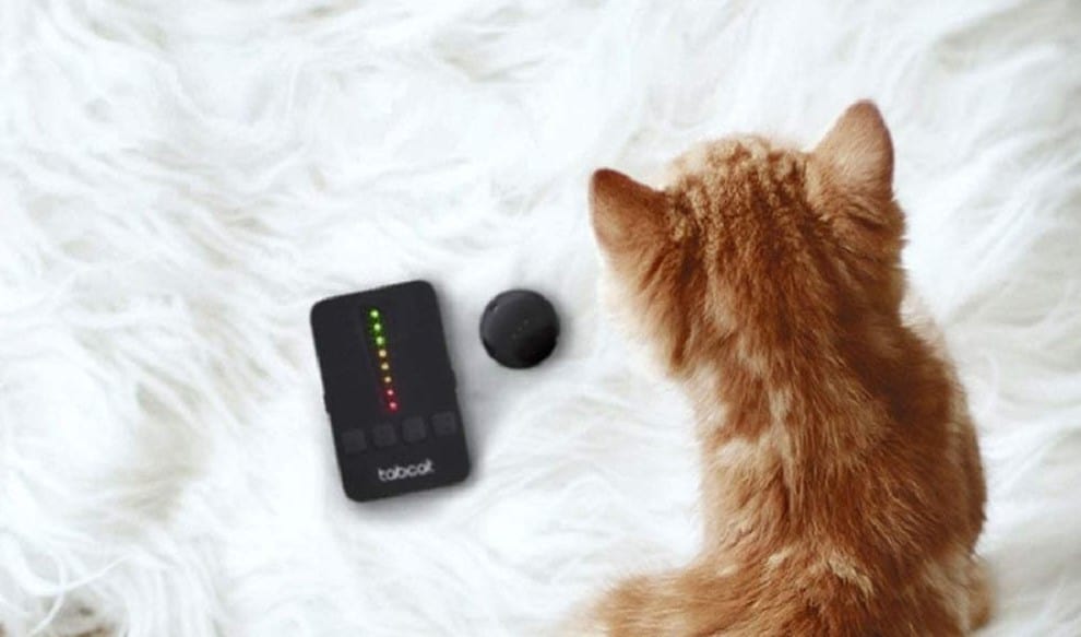
Stay connected via two-way messaging that text your contacts and even post to social media. The inReach Mini allows you to trigger an SOS message to response centers that are monitored at all times. You and those at home can track your route and location. You can ping your location at any time to friends and family. This compact device also receives up-to-date weather info for your current locations or for future waypoints and future dates. Even though it’s small, this GPS has fantastic battery life — up to 24 days in power-saving mode or over 90 hours with regular use. If you’re a cat owner, the best GPS tracker for cats is another great tool.
#9 goTele GPS Tracker for Hiking
Award: BEST FOR GROUPS
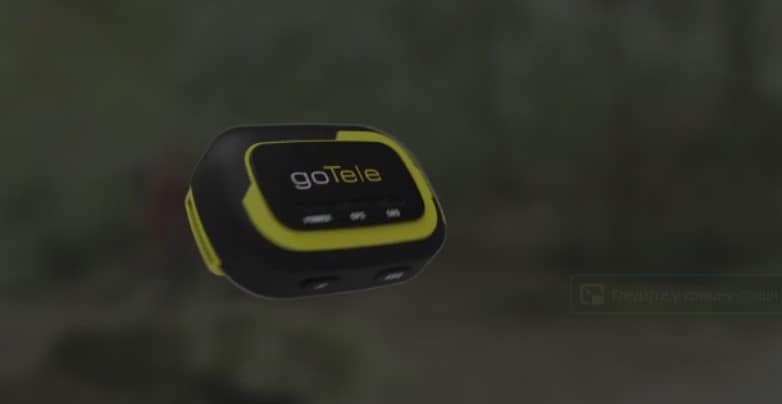
WHY WE LIKE IT: Keeping track of a large group of people is easy with the goTele GPS Tracker, as you can view the real-time location and trajectories of everyone in your group on one interactive map. It also has great messaging features to keep everyone connected and aware of their location.
- Connect up to 30 people at once
- Messaging even without service
- Track real-time locations and trajectories
- Must use with smartphone for navigation
For social hikers, the goTele GPS Tracker offers fabulous real-time tracking for hiking groups of up to 30 people simultaneously. The goTele device works by pairing with your smartphone and sending real-time location data and other info to its hiking GPS tracker app for easy navigation and communication. On your phone, you can view the locations of everyone in your group, including pets, and their projected trajectories. goTele offers offline maps you can use for navigation as well, like Google Satellite, Google Map, Google Relief, Open Cycle, and Open Street.
goTele devices stay connected with one-another at distances of up to five kilometers, even when there is no cell service or WiFi available. It also enables you to send messages between parties in those situations. The device is very rugged, as it has an IP67 waterproof rating, is dustproof, shockproof, and can withstand extreme temperatures as low as -4 degrees and as high as 140 degrees Fahrenheit.
#10 Garmin Rino 700 GPS Tracker for Hiking
Award: BEST COMMUNICATION FEATURES
WHY WE LIKE IT: The Garmin Rino 700 allows you to navigate in real-time and communicate in real-time as well, featuring a built-in two-way radio and the ability to message other devices. Stay up-to-date on everyone’s location and routes with automatic position reporting.
- Unit-to-unit text messaging
- GMRS two-way radio with 20 mile extended range
- Voice-activated radio commands
- Not a touchscreen
The Garmin Rino 700 is fantastic for navigation and two-way communication. Its built-in 5 W GMRS two-way radio offers 20 miles of extended range communication beyond the GMRS frequency, meaning you can count on it for staying in touch no matter how far you are from other parties. The device allows you to store 50 radio contacts and even has a feature to store track points for each so you can keep updated on their location. Radio is VOX enabled, so you can start a conversation quickly and easily with voice activation.
In addition to radio communication, this Garmin GPS features unit-to-unit messaging, which comes in handy in case you can’t hear well or need to communicate nonverbally. You also have the ability to turn on automatic position reporting for everyone in your party. Every Rino device on the same channel will display on the base map and you’ll receive automatic updates on their locations. Request a person’s location with one-touch using the position polling feature and quickly ping your location as well. This kind of communication technology definitely ranks this device as one of the best GPS for hiking and hunting.
How We Decided
While many GPS devices can be used for hiking and outdoor purposes, we specifically looked at a wide range of handheld devices that had features specifically designed for hiking purposes. These GPS devices had to be waterproof rated, built durably, and have high-sensitivity receivers at minimum. We also only considered GPS trackers that have over a day of battery life at normal use on a rechargeable battery, while also having the option to swap in a fresh battery if needed.
From there, we looked at some foundational specs that, while seemingly basic, affect the functionality, convenience, and usability of a device greatly. These specs include size, weight, screen type (color, monochrome, touch, etc.), and physical controls. These specs are largely preferential and depend greatly on the type of device you want and how you use it. A large touchscreen, for example, will increase the weight and size of a handheld GPS tracker greatly. We weighed and scaled the pros and cons of each of these features carefully when researching trackers.
Many outdoor GPS trackers also offer advanced features, including altimeters, digital compasses, messaging, and more. While excellent navigation and plotting capabilities were the priority, we found that the best current GPS devices also had sensors for elevation, direction, and weather. This was especially true for devices that integrated that information usefully with their GPS navigation.
Best GPS Trackers for Hiking Buyer’s Guide
The Most Important Features to Consider
- Interface and Design
Though there are many different outdoor GPS devices to choose from, one of the most important decisions in finding the best one for your use is deciding what type of interface and design you want. While most GPS trackers for hiking are considered “handheld” devices, the size and weight of them vary greatly. For the most part, trackers with larger, color touch screens are bigger and heavier. While a touch screen may seem high-tech in the store, consider how you’re using it, as many hikers find that using physical controls is easier when outdoors. - Size and Weight
Even though the difference in size and weight among handheld GPS units for hiking is within inches and ounces, it can make a big difference on a long hike. Think about holding your cell phone in your hand for eight hours straight — it will get tiring. Some GPS trackers are designed to be ultra-lightweight and compact, so you can slide it in and out of your pocket easily and without noticing the weight. Imagine yourself bringing the GPS on a long hike and decide how it will feel. - Advanced Features
Are you planning to use your GPS device for anything in addition to navigation? More advanced GPS units have barometers, an electronic compass, a more advanced accelerometer, more extensive map programs, and options, and even radio communication and messaging. If any of these features entice you, look at devices that include them, and allow you to make use of them at a high level. Generally, these advanced features will increase the cost of the GPS dramatically, so only consider ones you really plan on using regularly.

![10 Best GPS Trackers for Hiking in [year] 1 Best GPS Tracker for Hiking](https://www.gadgetreview.dev/wp-content/uploads/Best-GPS-Tracker-for-Hiking.jpg)


![10 Best GPS Trackers for Hiking in [year] 2 Garmin GPSMAP 64x, Handheld GPS, Preloaded with...](https://m.media-amazon.com/images/I/41WfHpWkEKL._SL160_.jpg)
![10 Best GPS Trackers for Hiking in [year] 3 Garmin 010-01735-10 inReach Explorer+, Handheld...](https://m.media-amazon.com/images/I/41P3hrSscpL._SL160_.jpg)
![10 Best GPS Trackers for Hiking in [year] 5 Garmin Instinct, Rugged Outdoor Watch with GPS,...](https://m.media-amazon.com/images/I/41f451JyRSL._SL160_.jpg)
![10 Best GPS Trackers for Hiking in [year] 10 Our #4 Pick is the Garmin eTrex 10 GPS Tracker for Hiking](https://m.media-amazon.com/images/I/41qHNvjswPL._SL160_.jpg)
![10 Best GPS Trackers for Hiking in [year] 12 Our #5 Pick is the Bad Elf 2200 GPS Tracker for Hiking](https://m.media-amazon.com/images/I/514asntmNuL._SL160_.jpg)
![10 Best GPS Trackers for Hiking in [year] 13 Our #6 Pick is the Garmin Montana 680 GPS Tracker for Hiking](https://m.media-amazon.com/images/I/413Ud2G+qAS._SL160_.jpg)
![10 Best GPS Trackers for Hiking in [year] 15 Our #7 Pick is the Garmin Oregon 700 GPS Tracker for Hiking](https://m.media-amazon.com/images/I/51W5ga8JnPL._SL160_.jpg)
![10 Best GPS Trackers for Hiking in [year] 16 Our #8 Pick is the Garmin inReach Mini GPS Tracker for Hiking](https://m.media-amazon.com/images/I/31uEqnUt3tL._SL160_.jpg)
![10 Best GPS Trackers for Hiking in [year] 18 Our #9 Pick is the goTele GPS Tracker for Hiking](https://m.media-amazon.com/images/I/3184QZldbHL._SL160_.jpg)
![10 Best GPS Trackers for Hiking in [year] 19 Our #10 Pick is the Garmin Rino 700 GPS Tracker for Hiking](https://m.media-amazon.com/images/I/41gwHnjTmoL._SL160_.jpg)


![Best GPS Tracker in [year] ([month] Reviews) 21 Best GPS Tracker in 2026 (January Reviews)](https://www.gadgetreview.dev/wp-content/uploads/best-gps-tracker-image.jpg)
![10 Best Cat GPS Trackers in [year] 22 10 Best Cat GPS Trackers in 2026](https://www.gadgetreview.dev/wp-content/uploads/best-cat-gps-tracker.jpg)
![10 Best Car Trackers in [year] 23 10 Best Car Trackers in 2026](https://www.gadgetreview.dev/wp-content/uploads/Best-Car-Tracker.jpg)
![10 Best GPS Trackers for Bikes in [year] 24 10 Best GPS Trackers for Bikes in 2026](https://www.gadgetreview.dev/wp-content/uploads/Best-GPS-Tracker-for-Bikes.png)
![10 Best GPS Trackers for Motorcycles in [year] 25 10 Best GPS Trackers for Motorcycles in 2026](https://www.gadgetreview.dev/wp-content/uploads/Best-GPS-Tracker-for-Motorcycles.jpg)
![10 Best GPS Phone Trackers in [year] 27 10 Best GPS Phone Trackers in 2026](https://www.gadgetreview.dev/wp-content/uploads/Best-GPS-Phone-Tracker.png)
![10 Best Dog GPS Trackers in [year] 28 10 Best Dog GPS Trackers in 2026](https://www.gadgetreview.dev/wp-content/uploads/best-dog-gps-tracker.jpg)
